There might not be scientific consensus on the frequency of destructive storms increasing across the globe, but there is widespread agreement that the intensity of storms is increasing. A 2019 study confirmed that there has been increasing intensification of these storms; a paper from 2020 finds that cyclones reaching at least category 3 have increased in the last 40 years; and the IPCC AR6 also confirm, with medium to high level of confidence, that the increased intensities will continue into the future. Even research from 2005 found more hurricanes reaching category 4 and 5 in the 15 year period leading up to 2005, than the 15 year period before that. What there has been less consensus on is the reason for this increased intensity. Weather patterns or natural cycles have been blamed by many. And, well, these phenomenon are a natural part of our climate system…but we’re now experiencing anomalies. And there is a strong case to be made for a link to climate change, and more specifically, global warming.
In 2020 there were more named storms in the Atlantic basin than ever before. It was only the second time that they ran out of names. There is a set of 6 lists, each containing 21 names for each Tropical Cyclone basin, on rotation year to year. If a storm has been especially destructive and/or costly, the name will be retired from the list, like Katrina, Sandy, Harvey, Irma…and one would expect the same fate could meet Ida also. From 1998 there have only been 3 years which haven’t required a name to be struck from the list.
While the word storm is used generically to describe any violent atmospheric disturbances, marked by clouds, rain, winds, thunder, lightning or snow, in meteorological terms the word is restricted to cyclones. But in different geographies, cyclones are called different things: hurricanes in the North Atlantic Ocean and eastern North Pacific, tropical cyclones in the South Pacific and Indian Ocean or typhoons in the western North Pacific around Philippines, Japan and China. From this point the word storm in this article meets the meteorological definition.
We have questionable increase in frequency, certain increase in ferocity, and a link between intensity and human activity/greenhouse gas emissions. But how? What is it exactly which causes these storms?
According to University of Florida meteorologist Athena Masson, there are three key ingredients for a storm to form: 1. warm sea surface water of at least about 80 degrees Fahrenheit (26.5 C); 2. a thick layer of moisture from the sea surface extending to roughly 20,000 feet; 3. minimal vertical wind shear so the thunderstorm can grow vertically without interruption.
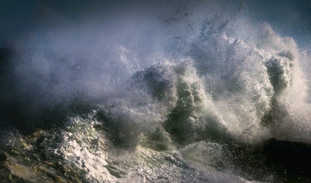
Let’s dive a little deeper. They usually begin near the equator, where the ocean temperature is warmer and the air is moist. It all starts with very innocent evaporation of sea water. The rotational movement of the Earth then creates winds, clouds, and thunderstorms. If the wind speed reaches 23 miles (36 km) per hour it gets upgraded from tropical disturbance to a tropical depression. If the circulation continues to intensify and the wind speed exceeds 39 miles (63 km) per hour, it gets upgraded again, to a tropical storm. Then once the maximum wind speed exceeds 74 miles (119 km) per hour the system is classified as a tropical cyclone. There are then 5 categories into which a storm can get allocated, according to the Saffir-Simpson Scale, dependent on their maximum sustained wind speed. This very often changes throughout the storm’s life cycle.
Once a storm forms it moves across the surface of the ocean, continuing to gain speed and strength, using heat from the atmosphere and ocean as fuel. The winds move in a circular motion (counter-clockwise in the Northern Hemisphere and clockwise in the Southern) and it’s this circulation of air which leads to the development of the ‘eye’ – the small area of calm, usually 20-40 miles across, in the center of the storm. Low air pressure forces water to form a mound near this eye, which can create the large wall of water known as the storm surge when the system hits land. The warmer the water and the shallower a continental shelf is, the larger the accompanying storm surge will be.
Prior to the system reaching land, however, it could dissipate. This will happen if it moves across cooler waters or gets so strong it starts to pull cool water up from the deeper ocean. Assuming it does hit land, it should then peter out fairly quickly. This was not the case for Hurricane Ida, a Category 4 storm, which didn’t drop to Category 3 for 8 hours after she hit land. And refused to lose more power for a further 7 hours. In remaining so strong for so long, she caused tornado touchdowns in 6 states.
After exploring the formation of hurricanes, climate change being a causation for increasing intensity is likely to be quite obvious. The warmer the ocean, the more likely a tropical disturbance is to start, but moreover, the greater chance it has to pick up speed. And we know that as the ocean continues to try to be an effective carbon sink, the waters are warming. Heat is like a charger for these storms. And this goes to the longevity of the storms, also. As we discussed, if a storm picks up cooler water from underneath the warm surface water it will die out. BUT, if the warmer water in the ocean extends beyond 100 feet, which is increasingly likely on account of global warming, there is less chance of cool water mixing, and the storm has more fuel.

Warmer ambient temperature allows for even faster wind speeds and leads to more water vapour in the air, which in turn creates more rain in the system and potentially dangerous dumps of rain to increase likelihood of flash floods. This recent paper also found that the speed of intensification has been increasing. This is potentially more dangerous than the category of storm – if we’re unable to warn people to evacuate they may then be left stuck and isolated in flood water, without power and drinking water for several weeks. And lastly, the rising sea levels we’re already experiencing will cause a higher risk of devastating storm surges.
Whatever the details of the increasing ferocity and worsening devastation of the cyclones/typhoons/hurricanes, there is little doubt it’s happening. Like the fierce winds, we need to speed up in making our coastlines more resilient, plan better evacuations, and be ready for more people to voluntarily move inland to avoid the devastating risks. We implore that you pick up the baton and try to find a way to help. Get in touch with your local elected representatives and discuss the concerning trends and the alignment between climate change and the worsening storms. Discuss adaptation, especially if you’re coastal, but also mitigation efforts to help speed up global decarbonization. In addition to chats with your elected officials, have the conversation with your friends and family. This is time for all hands on deck.