Clouds are condensed moisture. They are a collection of tiny water droplets or ice crystals floating in the sky. Sometimes they float high up in the atmosphere, while other times, they appear so low as if we could reach out and touch their fluffiness. At any given moment, clouds cover approximately 2/3 of our planet. This is incredibly significant, as clouds act to both heat and cool our planet. Their height and structure determines which. Without any clouds at all, our planet would be considerably warmer. Let’s take a quick look at some general cloud formations which impact climate:
Stratus clouds are one of the low-level cloud types, and these would be best described as sheet-like in appearance, thick and with a grey color. They are best at reflecting the sun’s radiative energy, thereby have a net cooling effect on the Earth’s temperature.
Cumulus clouds can occur at low or mid level, and these are the stereotypical cotton ball style clouds we all drew in elementary school. When they’re low they have a cooling effect, but if they form higher up, they will trap heat and prevent it from being reflected back into space.
Cirrus clouds are those wispy formations, taking on the look of cotton candy or feathers. They’re very high in altitude, so made up predominantly of ice crystals rather than water. Despite that make-up, they’re considered a blanket round the Earth, preventing heat from leaving our planet. On a winter’s night when you might expect very cold temperatures, the presence of these clouds will keep the temperatures much more pleasant than on a cloudless night.
Clausius-Clapeyron
So what’s all this got to do with climate change? Unfortunately, quite a lot. The reason it’s unfortunate is that it seems clouds have long been underestimated in their impact. They have been an enigma; a loose cannon; unpredictable – which, obviously, is unhelpful in trying to make climactic predictions, and get consensus on said predictions. What has been well documented for years is that there is feedback between climate and clouds. The type and location of cloud formations has an impact on climate, and conversely, climate and overall warming of our atmosphere has an impact on cloud formation. But none of that happens in a uniform way. That is, while global warming is certain to increase clouds, it might see more of a particular type in a particular place, but a decrease in other types and locations. Why would there be an increase in any clouds as the atmosphere warms? Because there’ll be an increase in the amount of water moving through the hydrological cycle. In fact, according to the Clausius-Clapeyron equation, 7% more moisture is held in the atmosphere for every 1 degree Celsius of warming. We explored that theory a little while ago, here.
And the problem with the variability of more clouds forming is the vastly different heat-related behaviors they exhibit. A marked increase in high cirrus clouds means a significant amount of infrared energy captured, leading to further heating of the atmosphere. But increases in the bright white clouds, more often lower to the surface, would mean a more moderated temperature of Earth.
How much warming?
With the fact of our atmospheric carbon dioxide increasing, and the understanding that that will bring (and is already bringing) an amplified greenhouse effect and global warming, the big question has been ‘how much warmer’? Scientists have been working for decades to try to answer this. They’ve used a theoretical volume of atmospheric carbon dioxide of double that of pre-industrial times. In the 1800’s atmospheric CO2 was at 280 ppm (parts per million), and at current rates we can expect to hit 560 ppm around the year 2050. Right now, we’re already sitting around 414 ppm. This parameter, or temperature range, is called equilibrium climate sensitivity. And as you would have noticed, there is no exact figure for it. Until last year, we had a range of 3° Celsius between best-case and worst-case scenarios for global warming (1.5-4.5°C). This large range had been held true for over 40 years, since a pivotal scientific assessment in 1979, despite a great deal of further research. The climate sensitivity range has been so large that I wonder if it might have been partly to blame for the slow speed of people to take action. Best case scenario really wouldn’t bring too bad of a selection of climate change impacts. Worst-case was so bad that it was simply all over for humanity, so why bother making lifestyle inhibiting changes for naught gain?

This is no longer the case, however, with some robust research coming from a few different sources which have narrowed the climate sensitivity. One such paper suggested with a 66% probability the range would be 2.6 – 3.9°C. The reason a smaller range is important, as stated by one of the authors is that it’s not so low we can ignore it and it’s not so high we should despair. In addition, it provides a more clear timeline for serious action, helps to outline the specific climate impacts which we can expect and therefore provides a basis for policy. The most recent IPCC AR6, Climate Change 2021, cited the most likely range to be 2.5 – 4°C, updating their thinking from the AR5 which held onto the older assessment. Much of this new clarity is due to deeper understanding of clouds, and comprehensive assessment of feedbacks in different cloud regimes.
Cloudy, with a chance of catastrophe?
Currently, the overall effect of clouds in our atmosphere is a net cooling one. But recent research suggests that will change. One paper published in March this year suggested that the climate sensitivity would be around 3.5°C, while another published in June this year offered 3°C as a prediction. Both of these studies appeared in Nature Climate Change, and focused on the implications of clouds and their feedbacks to arrive at their findings. Merely weeks later, a further study was published in PNAS (Proceedings of the National Academy of the Sciences of the United States of America) from the Imperial College London suggests (with a 97.5% probability) that we will see at least 3°C of warming, and have all but ruled out anything less than 2°C rise. The difference with this paper was that researchers used machine learning, which they suggest has led to attainment of much more robust cloud data than has been used before. They expect that as we experience further climate changes clouds will both reflect less heat and trap more heat, amplifying global warming significantly. The IPCC AR6 Report also concludes that there is overwhelming evidence for net positive cloud feedback. All the previous uncertainty and ambiguity around the effects of clouds and the effects of climate change on them, and the subsequent climate impacts from them seems to have put to bed. Clouds might look light and fluffy, and sometimes tickle our funny bone with unusual shapes – but they are absolutely complicit in our current climate trajectory worsening.
What to do
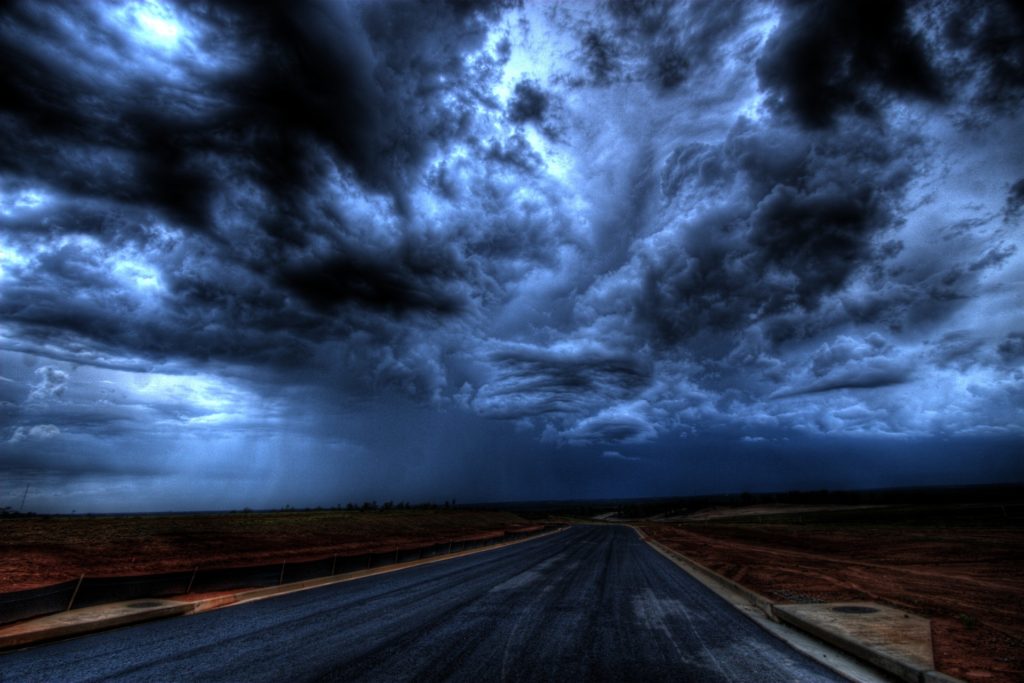
It won’t surprise you to read this: please do all that you can to reduce your personal carbon footprint, and you could start with diet and food waste as these can be fairly quick wins. Please become active politically, with writing letters and petitions and arranging meeting with your local elected officials, providing the scientific (and economic) evidence to invest in renewable energy infrastructure and say no to new fossil fuel exploration. And please have this conversation with as many people as you can. This fight needs numbers. The road ahead doesn’t have to resemble the one pictured below.